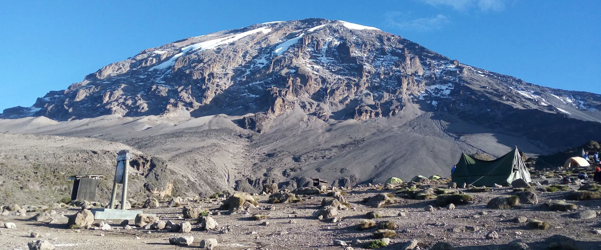
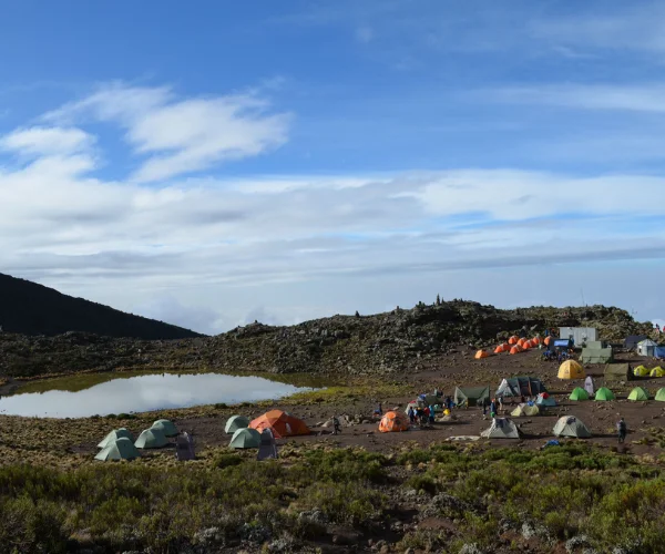
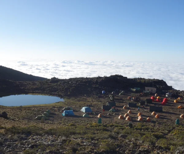
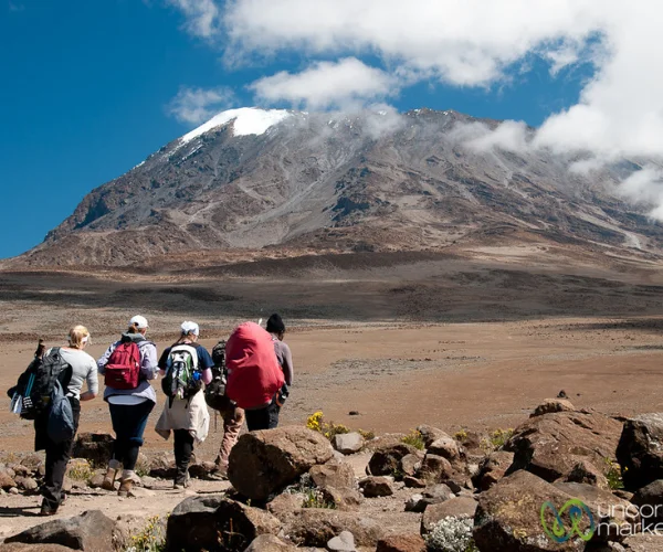
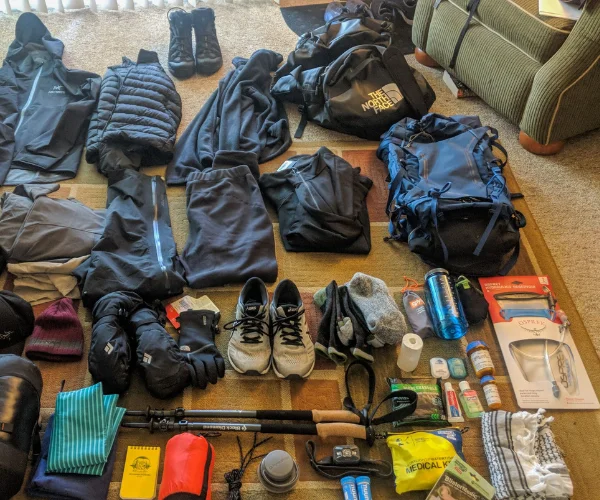
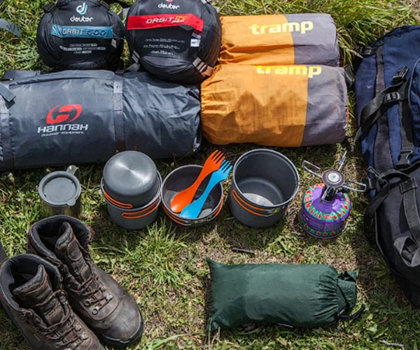
6 days Kilimanjaro trekking via Rongai route

rongai

Kilimanjaro via Rongai Route.


Major Attractions:Mt.Kilimanjaro,freestanding mountain in the world.


Mountain Guides Language: English,Germany,French.


Start From: Moshi.


Ending : Moshi.


Route Info: Rongai Route begins at the remote, northern side of Kilimanjaro near the Kenyan border. We hike through a true wilderness area towards the jagged Mawenzi Peak, then cross a barren desert saddle, before climbing up Kibos eastern crater wall. The Rongai route is a more gradual ascent, therefore preferred by those with little or no backpacking experience, but is equally enjoyable for even the most beautiful route in which you can see the wild animals.


Day 0: Arrive in Tanzania

You will be picked up at the Kilimanjaro International Airport and transferred to your hotel in Moshi town (Keys Hotel, Panama garden resort, or Kilimanjaro Wonders Hotel); you will meet your guide who will brief you on your upcoming trek and do an equipment check to make sure you have all the necessary mountain gear. The missing gear can be rented on this day.Meals: No Meals Included.

Day 1: Rongai Simba Camp (2,600 m)


Elevation (ft): 6,398 ft to 9,300 ft

Distance: 7 km

Hiking Time: 3-4 hours

Habitat: Rain Forest


After completing the necessary registration formalities at Marangu National Park gate, the porters and guides will be ready and go back to the car drive to Rongai gate. The climb begins from Nale Moru (1,950 m) on a small path treks through the fields of maize and potatoes before entering pine forest. Starts to climb consistently, but gently through attractive forest that shelters a variety of wildlife, including the beautiful Kilimanjaro Colobus monkey. These monkeys are black with a long of white hair and a flowing white tail. The forest begins to thin out and the first camp is at the edge of the moorland zone, Rongai One Camp (2,600 m) with extensive views over the Kenyan plains.

Day 2: Rongai Cave to 2nd Cave to Kikelewa Cave


Elevation (ft): 9,300 ft to 11,811 ft

Distance: 12 km

Hiking Time: 6-8 hours

Habitat: Health


we now leave the main trail and strike out across the moorland on a smaller path towards the jagged peaks of Mawenzi. Our campsite is in a sheltered valley with giant senecios near Kikelewa Caves (3.600 m). After lunch, there is time to explore the valley or to rest.

Day 3: Kikelewa Cave to Mawenzi Tarn Hut


Elevation (ft): 11,811 ft to 14,160 ft

Distance: 5 km

Hiking Time: 3-4 hours

Habitat: Alpine Desert


A short but steep climb is rewarded by superb all round views and a tangible sense of wilderness. We leave vegetation behind shortly before reaching the next camp at Mawenzi Tarn hut (4,330m), spectacularly situated in a cirque directly beneath the towering spires of Mawenzi. The afternoon will be free to rest or explore the surrounding area as an aid to acclimatisation.

<

DAY 4: Marwenzi Tarn to Kibo Hut


Elevation (ft): 14,160 ft to 15,430 ft

Distance: 8 km

Hiking Time: 5-6 hours

Habitat: Alpine Desert


We cross the lunar desert of the ‘Saddle’ between Mawenzi and Kibo to reach Kibo campsite (4,700m) at the bottom of the Kibo crater wall. You will meet other people from Marangu route who will be staying in the hut. The remainder of the day is spend resting in preparation for the final ascent before a very early night.

Day 5: Kibo Hut to Uhuru peak to Horombo Hut


Elevation: 4700m/15,500ft to 5895m/19,340ft

Down to 3700m/12,200ft

Distance: 6km/4mi up / 15km/9mi down

Hiking Time: 6-8 hours up / 15km/9mi down

Habitat: Alpine Desert.


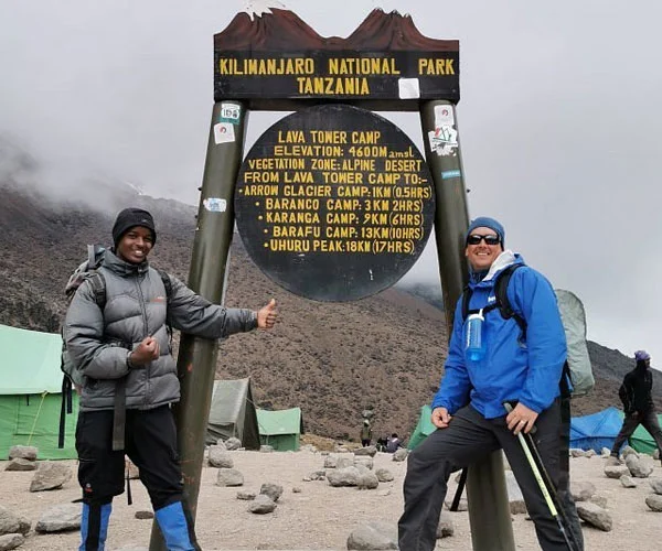
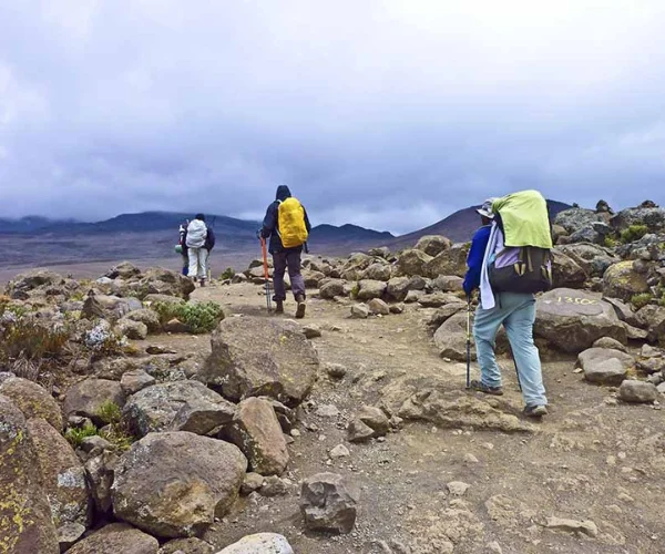
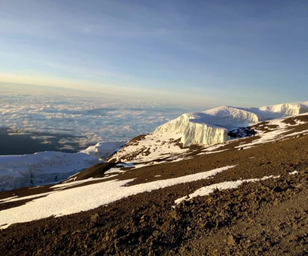
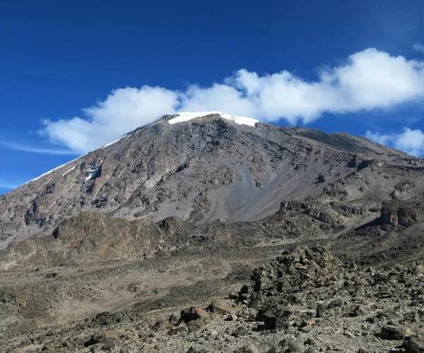
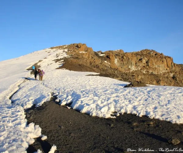
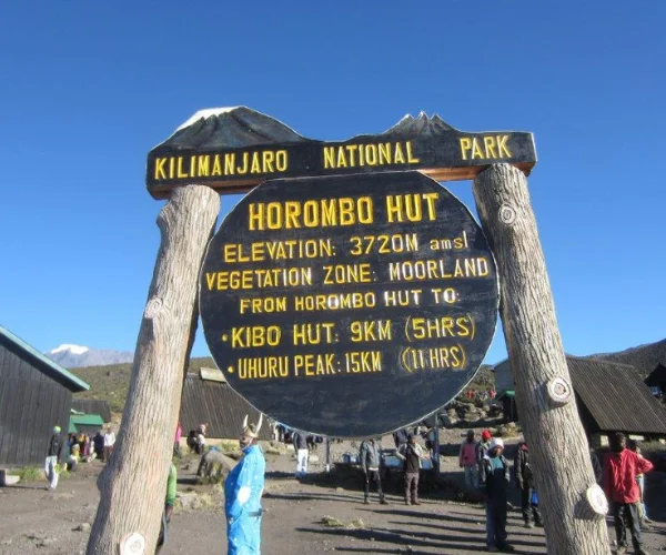
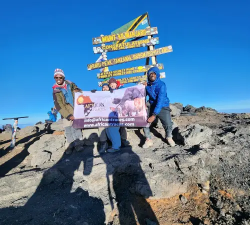
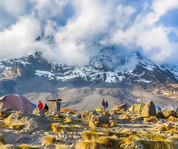
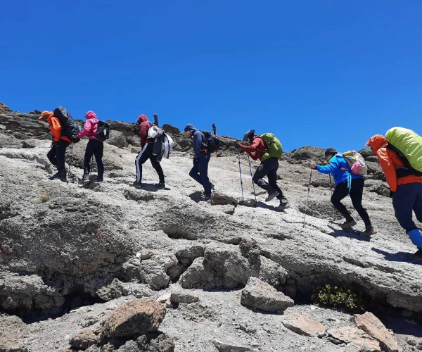
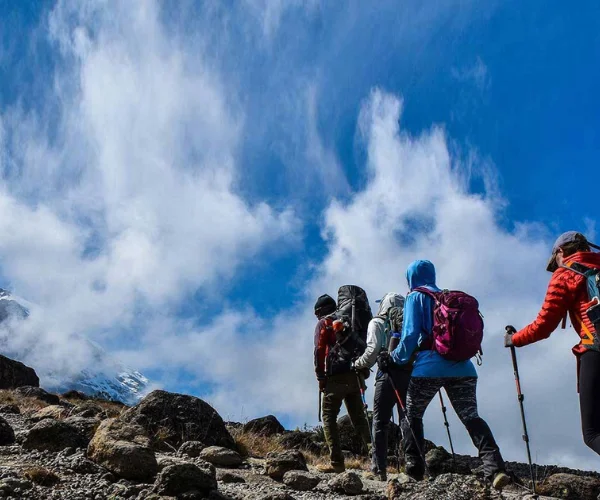
we will start the final, and by far the steepest and most demanding, part of the climb by torchlight around 1 a.m. We plod very slowly in the darkness on a switchback trail through loose volcanic scree to reach the crater rim at Gillmans Point (5,685 m) we will rest there for a short time to enjoy the spectacular sunrise over Mawenzi. Those who are still feeling strong can continue to the next two peaks Stella point and Uhuru Peak (5,896 m), passing close to the spectacular glaciers and ice cliffs which surrounding most of the summit area. The descent to Kibo (4,700 m) is surprisingly fast in which you will have hot soup, juice for refreshment, we continue the descent to reach our final campsite at Horombo (3,720 m).
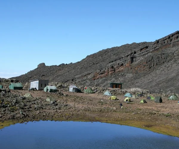
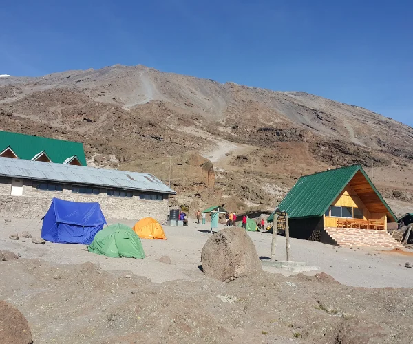
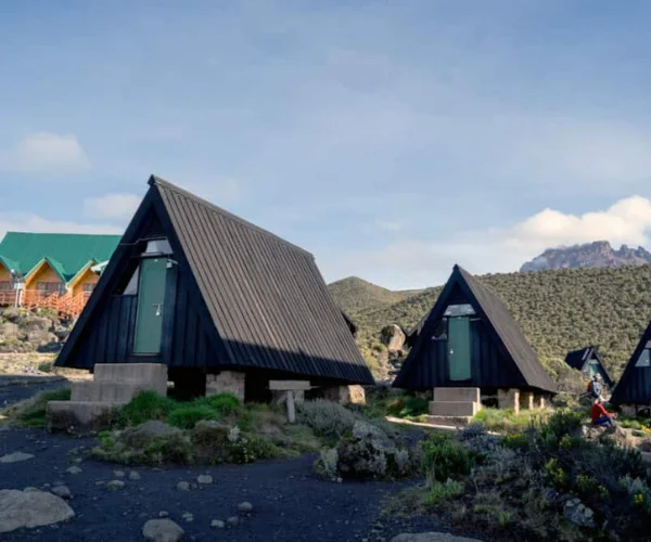
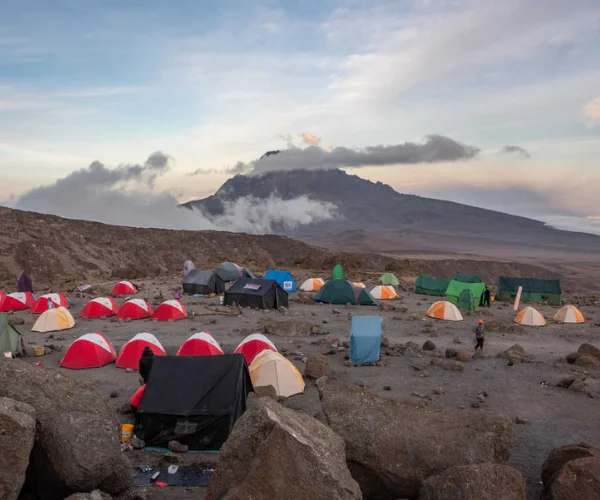
Day 6: Horombo Hut to Marangu Gate


Elevation: 3700m/12,200ft to 1700m/5500ft

Distance: 20km/12.5mi

Hiking Time: 4-5 hours

Habitat: Forest.


After breakfast you will celebrate with you team for Kilimanjaro song, jambo song then descent down through moorland to Mandara Hut (2,700m), the first stopping place at the Marangu route. We continue descending through lovely lush forest on a good path to the National Park gate at Marangu (1,830 m).

PRICE PER PERSON


GROUP SIZE AMOUNT (US DOLLAR)
1 Person $1850
2-5 People $1770
6-8 People $1710
8+ People $1650

Tips is recommanded for a group sharing as follows:
Guide $20/guide/day
Cook $15/day
Porters $10/porter/day


MT.KILIMANJARO TREKKING ROUTE

We contact Marko Mtui from African Traces about a month and a half before our trip to Tanzania in order to book ourself a safari trip. Marko was very communicative and answered all our questions and wonderings.
We checked a few Safari operators in Tanzania and decided to go with African Traces (which had the best "value for money" proposal and a lot of great reviews), and we couldn't choose better!

Learn More

Ich bin derzeit auf Weltreise und habe Marko und African Traces von einem anderen Reisenden empfohlen bekommen. Wir hatten unsere Kili-Tour (leider) schon woanders gebucht, eine Safari sollte noch Folgen.
Die Nummer per Whatsapp kontaktiert und es hat vom ersten Moment an gestimmt. Marko weiss was die Kunden wollen. Weiterlesen